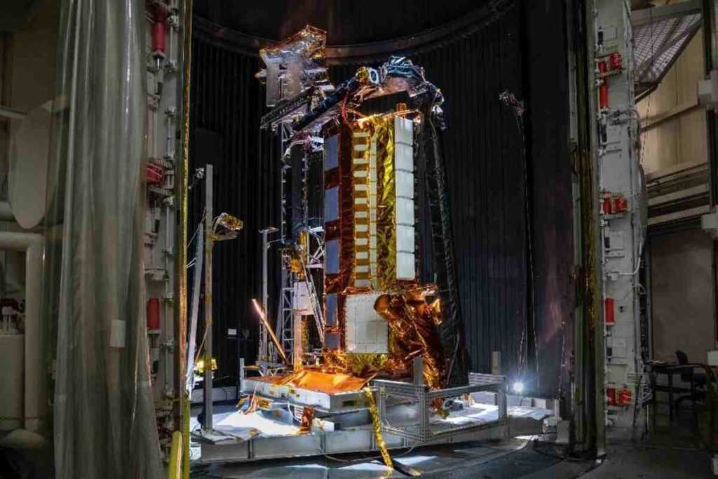
NISAR radar satellite jointly developed by US and India prepares for launch to monitor Earth's surface. NASA/JPL/AFP
The satellite will launch aboard an Indian Geosynchronous Satellite Launch Vehicle (GSLV) from the Satish Dhawan Space Centre at 5:40 p.m. IST (1210 GMT).
New Radar Satellite to Track Earth’s Surface Movements
Operating at an altitude of 747 kilometers (464 miles), the new radar satellite will scan the planet’s land and ice-covered regions every 12 days.
Using advanced synthetic aperture radar technology, it will be able to detect minuscule shifts in surface elevation and horizontal position, capturing early warning indicators of potential geological hazards.
These observations will help scientists monitor environmental processes and infrastructure risk across different regions.
Data from NISAR is expected to contribute to fields such as agriculture, forestry, hydrology, and urban planning by revealing long-term changes in terrain and land usage.
How the NISAR Satellite Enhances Earth Surface Monitoring
Equipped with a 12-meter deployable radar antenna and using both L-band and S-band frequencies, NISAR will produce high-resolution radar images regardless of weather conditions or time of day.
Also Read: US Faces Backlash Over Planned Destruction of $9.7M in Contraceptives
The dual-band capability will allow scientists to analyze various land types and conditions, including vegetated and ice-covered regions.
According to NASA, the satellite’s radar system can detect surface movements as small as a few millimeters.
This precision opens new possibilities for monitoring glacier movement, coastal erosion, groundwater shifts, and structural stability of man-made infrastructure such as dams and bridges.
US India Space Collaboration Launches Landmark NISAR Mission
The satellite project has become a milestone in expanding space collaboration between the two countries, reflecting broader cooperation in science and technology.
Initiated over a decade ago, NISAR symbolizes growing strategic ties fostered during the tenures of U.S. President Donald Trump and Indian Prime Minister Narendra Modi.
ISRO contributed the satellite’s S-band radar and launch services, while NASA provided the L-band radar, high-capacity data storage, and support through the Jet Propulsion Laboratory.
This bilateral mission also emphasizes transparency, with its data expected to be shared openly with the international research community.
Tracking Infrastructure and Human-Caused Hazards
Beyond natural disasters, the satellite’s data will assist in evaluating the integrity of aging infrastructure, including bridges, tunnels, and levees.
Subtle surface displacements can indicate potential structural weaknesses before failure occurs. Experts believe that this data will be vital for informing risk management and resilience planning.
Environmental scientists also anticipate that NISAR will support assessments of human impact, such as land subsidence due to excessive groundwater pumping or deforestation trends. Researchers will use the system to build historical data sets for long-term environmental monitoring.
NISAR Satellite Expected to Revolutionize Earth Observation
Weighing roughly 2,800 kilograms and the size of a pickup truck, NISAR is among the most advanced Earth observation platforms developed to date.
Experts say its ability to conduct continuous, high-resolution imaging will transform how scientists model and respond to global change.
The satellite will begin operations soon after launch, initially undergoing calibration before full deployment of its scanning systems.
Once fully operational, it will provide a new lens into the invisible shifts beneath Earth’s surface—contributing not just to science, but to safety and preparedness.

